


Our research group is based at King’s College London, and is led by Professor Martin Wooster. Our Staff hold leading roles in both the Leverhulme Centre for Wildfires, Environment and Society and the NERC National Center for Earth Observation (NCEO). We focus our research on (i) Earth Observation of Biosphere-Atmosphere Interactions, and (ii) Landscape Fire Science, including wildfires and anthropocentric burning. We are based within King’s Department of Geography and our scientists have backgrounds in Physics, Chemistry, Earth & Environmental Science, Mathematics, Physical Geography, along with a variety of other areas required to cover our interdisciplinary needs. Our work encompasses the planning and operation of airborne remote sensing campaigns, which are often run in parallel with ground campaigns and satellite overpasses.
Almost all the imagery found on this site was created or taken by our staff. We have a dedicated laboratory facility to house and maintain our instrumentation, located outside London at Rothamsted Research. This includes a large flexible electronics lab, workshop, environmentally controlled room, and optical lab. Together these enable us to calibrate instruments and devise new installations. Feel free to contact us through Prof. Martin Wooster (martin.wooster@kcl.ac.uk).
King’s College London (KCL) is an internationally renowned university delivering globally leading research. The NAEO is operated by staff within the King’s NCEO & Wildfire group, based within the department of geography. Scientists within the group have backgrounds in Physics, Chemistry, Earth & Environmental Science, Mathematics, Aviation, Physical Geography, along with a variety of other areas required to cover interdisciplinary needs.

The National Center for Earth Observation is a distributed centre of over 100 scientists from UK universities and research organisations, providing the UK’s Natural Environment Research Council (NERC) with national capability in Earth observation science – developing and applying ways to better understand and monitor the state of our planet through the exploitation of satellite instrumentation and more. Professor Wooster is one of NCEO’s Divisional Directors, and members of the NAEO are NCEO staff – providing expertise, technical support and datasets within NCEOs research projects and associated activities.

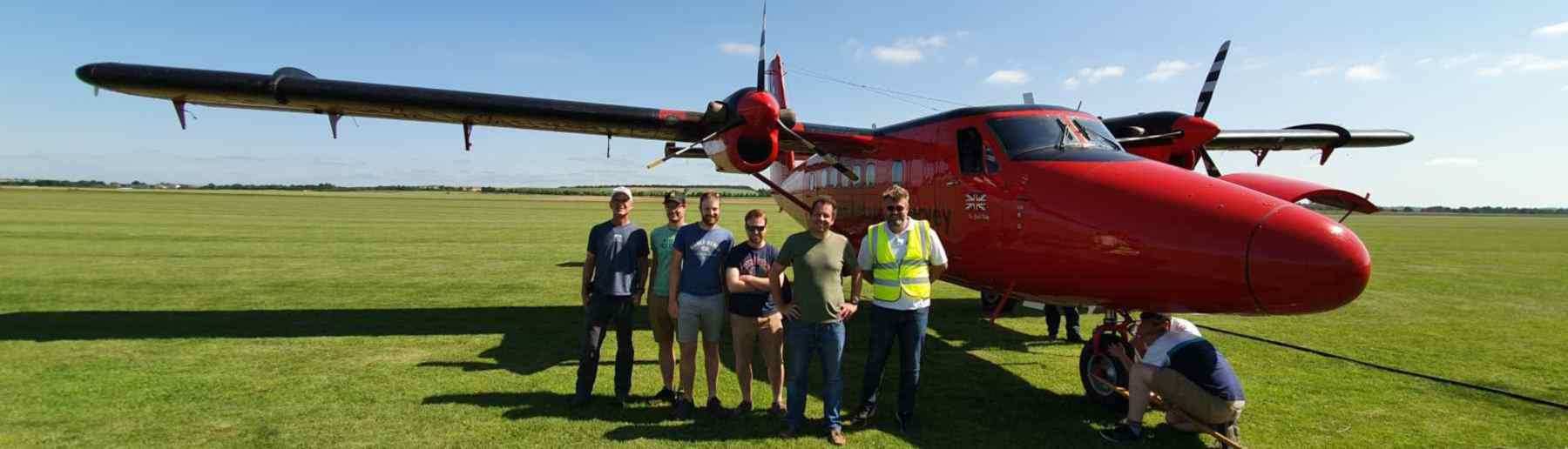
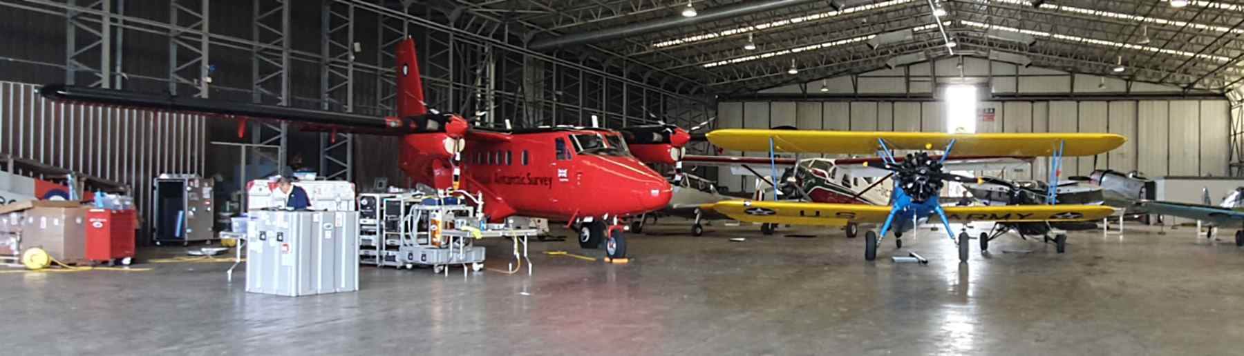
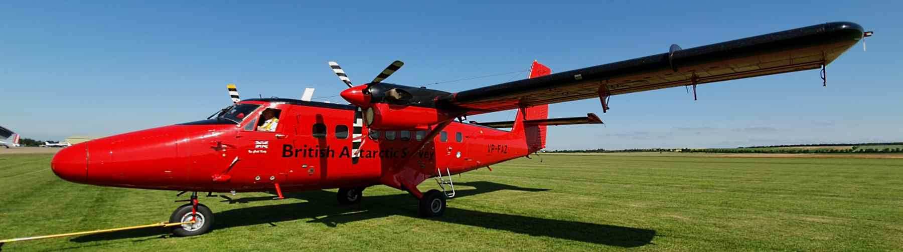
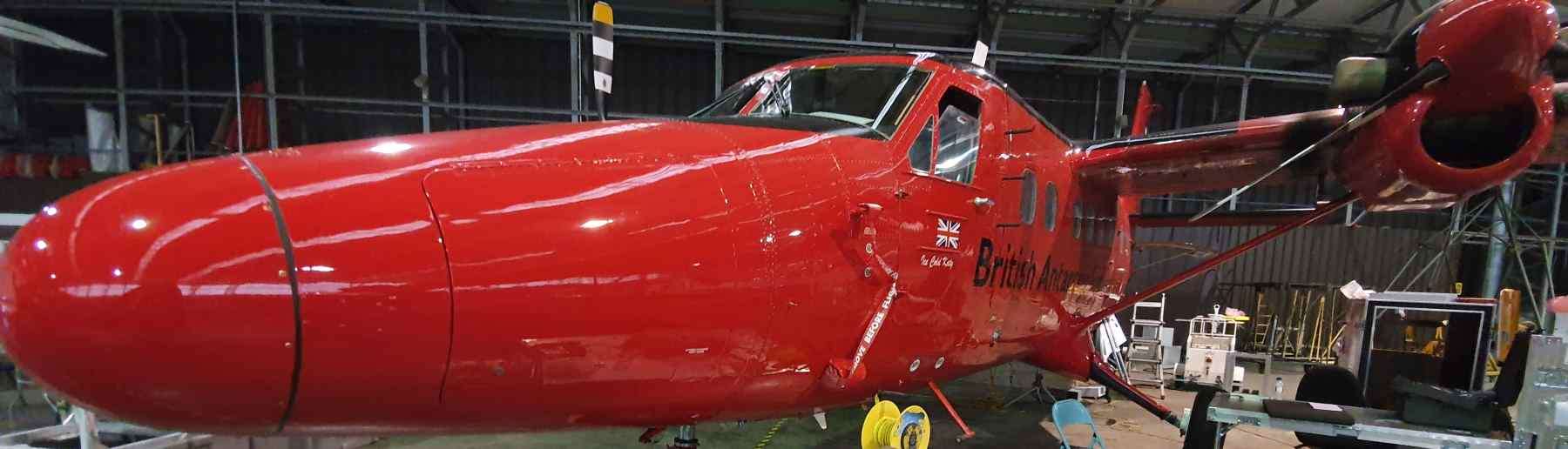
The British Antarctic Survey (BAS) is the UK’s leading polar research facility. It provides and enables world-leading research in the polar regions, aiming to advance understanding of the earth and human impacts on it. BAS is based in Cambridge, the antarctic and the arctic. The aircraft the NAEO use is operated by BAS, and is part of their suite of aircraft used for science and logistics in polar regions. The NAEO works with BAS staff and pilots all year round in the planning and operation of summer airborne campaigns.
The National Environmental Research Council (NERC) provides funding for environemental science in the UK. NERC invests public money in world-leading science, designed for advancing understanding of environmental change. NERC is a council of UK Research and Innovation (UKRI), the UK governmental body responsible for directing R&I funding.
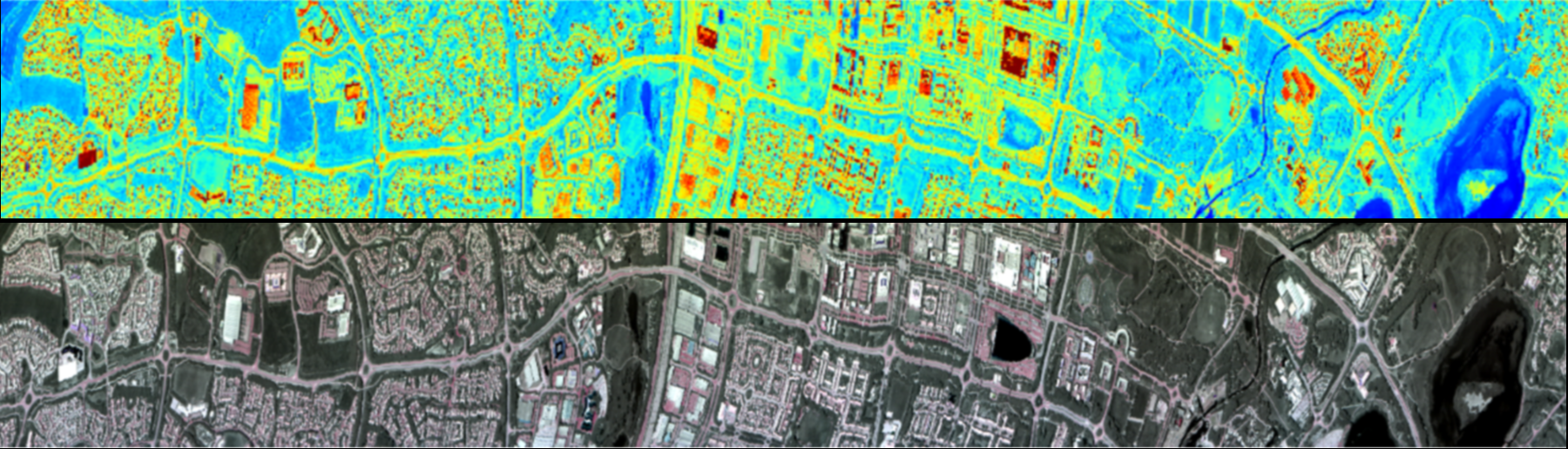
The NERC Earth Observation Data Acquisition and Analysis Service (NEODAAS) provides a range of services to support the use of Earth Observation. Based at the Plymouth Marine Laboratory, NEODAAS uses software developed in house to process airborne hyperspectral, thermal, LiDAR and digital photography data. From this data they create radiometrically and geometrically calibrated products to aid in future analysis.
The European Space Agency (ESA) is an international organisation made up of 22 member states, designing and executing a multi-disciplinary space programme. ESA has developed satellite technologies and services that can be used for remote sensing of the earth. NAEO works with ESA to validate satellite data as well as support future satellite mission planning.
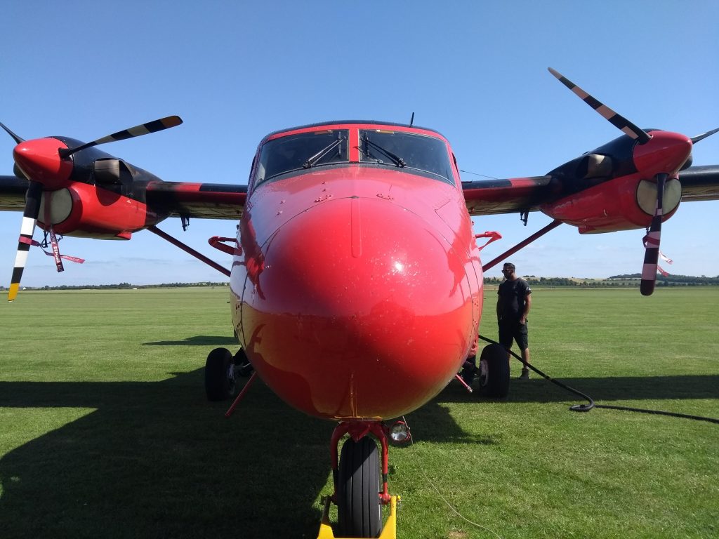
A De Hallivand Twin Otter Aircraft is used for remote sensing operations. It is a high-wing, twin-engine, turbo-prop aircraft. Designed for remote environments and renowned for their exceptional reliability, solid construction and ‘short take off and landing’ capabilities. The aircraft can be modified to fit an array of remote sensing and other scientific instruments, with multiple downward facing hatches at the middle and the back of the aircraft. The Twin Otter has double cargo doors providing good access for installation. The aircraft is usually flown at a height of 1km. Although the aircraft can reach a flying height of 5km, it has an unpressurised cabin, which means that crew would require supplementary oxygen at these heights.
| Wing Span | Length | Max. Take-off Weight | Complement | Range | Maximum Speed | Rate of Climb at Sea Level | Altitudes |
| 19.8m | 15.7m | 5,670kg | 1 or 2 Pilots and up to 4 mission operators/scientists | 1,435km (7hr 10 min) | 240km/h | 487m/min | 35m to 5000 m |
Every campaign undertaken by the NAEO will have different objectives, requiring differing operational parameters. These parameters are influenced by the area of interest, required instruments and instrument configuration, length and direction of flight lines, airspeeds required to achieve pixel resolutions, time of flights, Air Traffic Control Restrictions and weather conditions.
Area’s of interest are chosen primarily on the scientific goals of the campaign, but other important factors must be considered. There needs to be good access to a suitable runway, consideration of air traffic control (ATC) restrictions and the local seasonality.
The aircraft is loaned from the British Antarctic Survey (BAS), which means the NAEOs flight season runs approximately from May to September, with campaigns usually running for 1-4 weeks. There is often an airborne and a ground team operating and completing science at the same time, allowing for comparison and validation of collected data.
Flight line swath width is determined by the altitude flown by the aircraft. Flight line length is also a function of altitude as lower altitudes produces smaller pixel lengths, requiring more lines to cover a ground distance. Flights lines would ideally run parallel to ground targets, however with airborne remote sensing, data acquired can suffer from atmospheric distortions. To reduce these distortions, it is required to align the flight line so that the aircraft moves either towards or away from the sun, within a few hours either side of solar noon. This limits the presence of shadows which ideally should be no greater than 3.5 times the height of the object. If the reduction of these distortions is critical to the campaign, then the flight lines need to follow the sun, which could require multiple parallel flightlines being taken over a target area. Multiple parallel flightlines should have 20-30% overlap for complete coverage.
The pixel size obtained from airborne remote sensing is key for creating products with high spatial resolution. Pixel size is a product of both the specifications of the sensor as well as the flying height and speed of the aircraft. In order to acquire contiguous scanlines, the aircraft must be flown at an optimal groundspeed which is dependant on the integration time of the sensor. A lower flying height allows for greater spatial resolution but comes at the cost of reducing swath width. This means that more flight lines are required to cover a certain area and greatly increases the volume of data created. It is therefore important to find the optimum flying speed and height in order to collect data with high spatial and spectral resolution, without the need for unnecessary flight lines.
Flightlines should be flown in one direction to help maintain a consistent airspeed and negate the effects of potential headwinds. Winds in the transverse direction to the flight line can cause disruptions, however rotating the camera to the azimuth of the aircraft crab can overcome these issues.
Air Traffic Control (ATC) restrictions must be met when flying over target areas. The pilot will have to file a flight plan to gain the necessary permissions. It may be required that contact with local ACTs is required on the day of or at the beginning of a flight run, and last minute withdrawals of permission can occur.
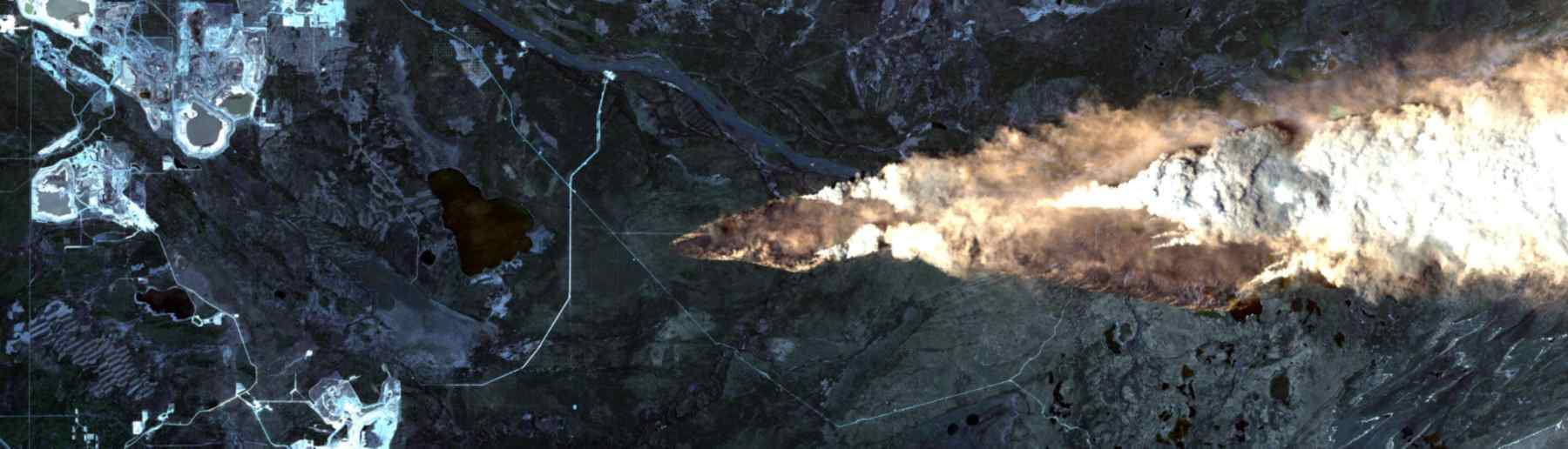
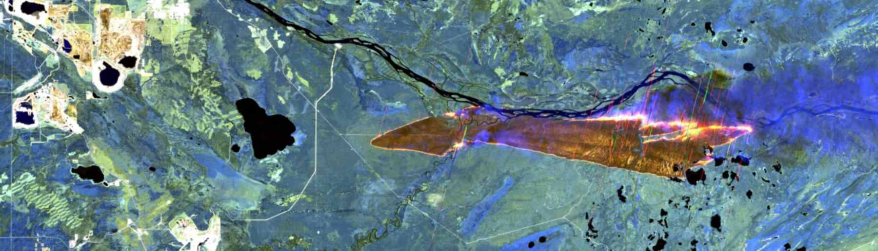
Weather Conditions impact campaigns to various degrees based on the requirements for said campaign. The proportion of acceptable cloud cover is dependent on the instruments used and the required data. For example, calibrating airborne or satellite sensors require near perfect cloud conditions, whereas other surveys, which aren’t as dependent on irradiance distribution, can still produce results with 20-25% cloud cover. The critical aspect is to ensure that cloud cover does not impede, either directly or indirectly through shadows, on the data acquisition targets. Some surveys can be carried out under complete cloud cover, where the homogeneity of solar iridescence is required, i.e. deriving consistent surface reflectance. High cirrus clouds can still impact absolute level of irradiance at the target and consequently the signal level of the aircraft. It should noted that at a 10,000ft flying height, the aircraft is viewing through 90% of the atmosphere’s optical thickness, where most of the atmospheric constituents impairing remote sensing are located. Obesrvations of fire, such as in the FIDEX campaigns, can be made at night as surface reflectivity isn’t important to the detection and measurement of active fires. The FIDEX campaign however still required clear skies, to allow for the satellites to be able to detect fires at the same time as the aircraft.
Weather conditions can vary dramatically and rapidly, and timing of flights need to coincide with seasonal or local history on the build and dispersion of cloud throughout the day. Using multiple weather forecasts is crucial for deciding on whether or not a flight is suitable, especially when long transits are involved and now ground observations of the sky can be made. Weather forecasts aren’t always 100% accurate and sometime the actual weather situation is different than the forecast, requiring the mission to be abandoned.
Ground-based fieldwork is carried out to collect a range of validation data via in-situ measurements or by sample collection for later analysis. Ground and auxiliary measurements can be carried out during, or as close in time to, the flights to improve the use and analysis of remote sensing data. Measurements often pertain to the acquisition of solar irradiance, radiance or surface reflectance from bright and dark targets contained within the airborne imagery. These data can be used to to correct airborne data or to remove or quantify a measure of various atmospheric optical properties, with simple measures of surface barometric pressure, temperature and humidity are useful when applying corrections to airborne data.
Data collected before and after flights are used to determine exact locations of Ground Control Points (GCPs). These are best made with a GPS used in differential mode to obtain the precede location of features which are easily identifiable in airborne data. GCPs can be used where very high precision geometric correction is required through the removal of residual translation errors resulting from the in-flight navigational system.
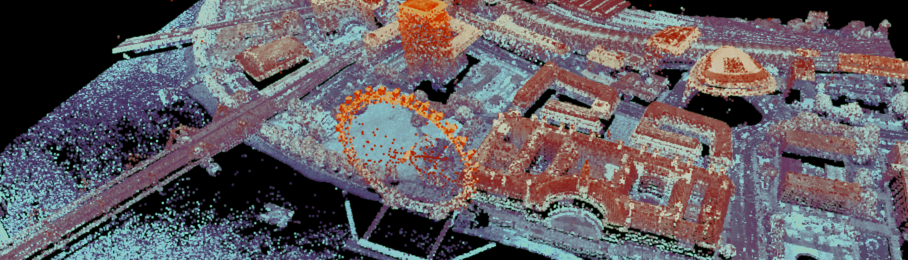
Data collected from NAEO campaigns are processed by NERCS Earth Observation Data Acquisition and Analysis Service (NEODAAS), based in Plymouth. NEODAAS generates radiometrically and geometrically corrected products (1b) from all of our instruments. Further data processing is required to map level 1b data to Level 3a/3b data products. Atmospheric corrections, using a radiative transfer model, are applied to achieve level 2 data products. These products then require mapping to a geographic co-oridanate system which uses on-board altitude and positional information (3a) sometimes with the addition of ground point controls (3b).
All of the Instruments are spectrally and radiometrically calibrated both before and after the season at the optics lab at Rothamspted Research. The lab has all of the facilities needed for a full calibration of the instruments.
In order to gain absolute radiometric calibration, Standard radiance light sources, with a high level of precision and stability, are used to measure the relationship between the known spectral radiance of the light sources and the subsequent DN values of each detector pixel. This relationship can be described using linear and nonlinear models.
King’s College London, Bush House (NE wing), 30 Aldwych, London, WC2B 4BG