
Multi-angular Thermal Retrievals
The M-Owl mount allowed the OWL instrument to be titled up to 36º, allowing it to make thermal retrievals at a high viewing angle.


The OWL is a commercial hyperspectral thermal imager operating in the long-wave infrared (LWIR, 7.6 – 12.6μm). It measures signals in 102 spectral bands at a 100 nm spectral resolution, providing data at a pixel size of 0.54m from a flying height of 1km. A twin blackbody system provides in-flight calibration, and the calibrated spectral can be used to derive pixel-based surface temperature and emissivity estimates. The emissivity data can be used for classification of materials, and under certain conditions even detection of plumes of certain trace gases having absorption regions in the LWIR (e.g. ammonia) maybe possible.
Measuring thermal emission, the OWL can give temperature estimations with known emissivity, as well as classifying emitted gasses. Thermal hyper spectral imaging can be especially useful for mineral mapping, as minerals have distinct LWIR reflectance. Typical applications include vegetation characterisation and species classification, forestry mapping, water quality monitoring and geological studies.
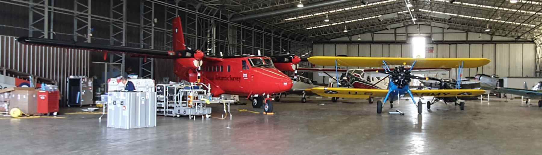
The NAEO has collaborated with NASA JPL to undertake campaigns with the Hyperspectral Thermal Emission Spectrometer (HyTES), with the instrument flying on the BAS Twin-Otter on multiple occasions. HyTES uses a push broom design with 512 spatial pixels and a 50˚ field of view. The instrument has 256 spectral bands between 7.5 and 12 µm in the LWIR region.
HyTES was first flown on the BAS Twin otter in 2019 as part of the joint NASA-ESA funded Temperature Sensing Experiment (NET-Sense), which aimed to monitor the variability of land surface temperature (LST) and evapotranspiration (ET) within European fields. It was next flown in 2021 on the MAGIC Campaign which aimed to better understand the vertical exchange of greenhouse gases along the atmospheric column as well as contributing to the preparation and validation of space missions dedicated to the monitoring of greenhouse gases. The campaign explored the feasibility of Methane anomaly detections and area flux estimated from HyTES CH4 retrievals.
HyTES was used again, in conjunction with the OWL during the joint NASA-ESA funded airborne campaign in 2023, where the two instruments were flown in separate aircrafts simultaneously. The campaign aimed to demonstrate the multi-angular effects on remotely sensed surface reflectance and LST, identifying situations where these effects are maximal. Data from this mission will be used as a case study for future satellite missions, focused on surface reflectance and LST measurement. More information on the project can be found here.
The M-Owl mount allowed the OWL instrument to be titled up to 36º, allowing it to make thermal retrievals at a high viewing angle.

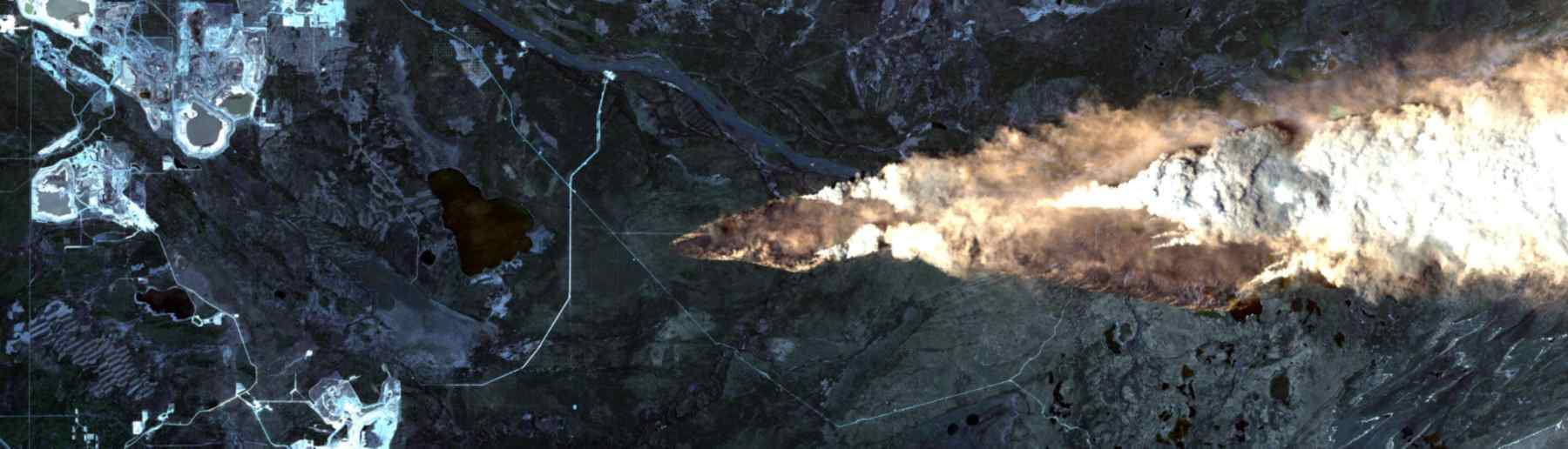
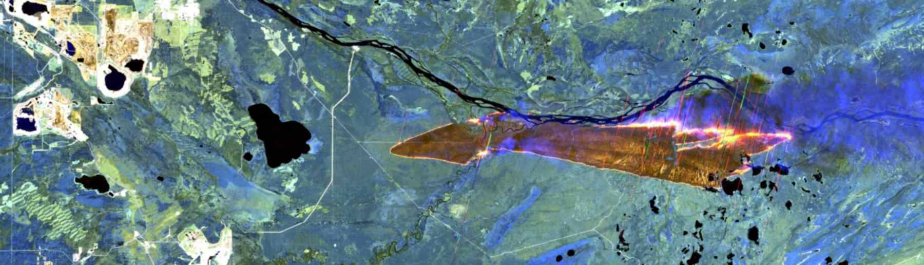
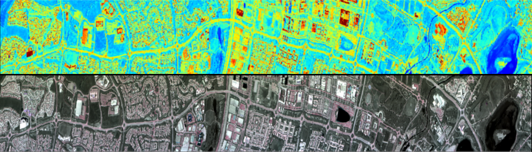
The images above show the full swath of a single flight line over northern Canada. The OWL thermal imagery and the optical imagery highlight two key areas, an ongoing active fire as well as a region of previously burned area.
Harris, L., et al (2017). Spectral characterization of the AisaOWL. IEEE Transactions on Geoscience and Remote Sensing, 55(5), pp.2751-2756.
Neinavaz, E., et al., (2021). Thermal infrared remote sensing of vegetation: Current status and perspectives. International Journal of Applied Earth Observation and Geoinformation, 102, p.102415.
Kotthaus, S., et al, (2014). Derivation of an urban materials spectral library through emittance and reflectance spectroscopy. ISPRS Journal of Photogrammetry and Remote Sensing, 94, pp.194-212.
King’s College London, Bush House (NE wing), 30 Aldwych, London, WC2B 4BG